Geoscience and mining
Your drillholes in three dimensions, in the browser
Your drillhole desurvey, displayed in 3D.
Included from the Personal plan
See the campaign at a glance
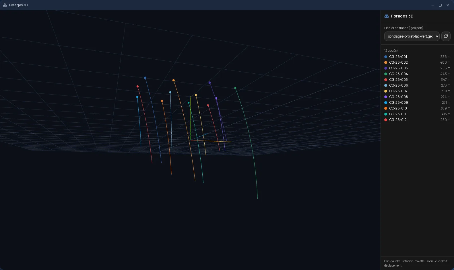
3D drillholes displays your drillhole traces in space, from their desurvey: each hole has its colour, its collar and its depth, and the legend lists them all. You rotate, zoom and pan with the mouse to read the orientation and spacing of the holes.
From your own files
The app reads a GeoJSON file of drillhole traces stored in your Files space. No geology software to install on the computer: the view opens in the browser, including on a tablet or phone in the field.
Alongside the rest of your exploration
3D drillholes is part of the Cloud OS mineral exploration tools, together with tracking of mining claims and their deadlines, and SIGÉOM layers imported by mining district.
Frequently asked questions
- What file format does 3D drillholes read?
- A GeoJSON file of drillhole traces (three-dimensional lines), with the identifier and depth of each hole.
- Do I need geology software installed?
- No. The 3D view opens in the browser, with nothing to install.
- Does 3D drillholes cost extra?
- No. It is included in the subscription from the Personal plan.